Weather map showing a stationary front
Windows to the Universe image by Lisa Gardiner
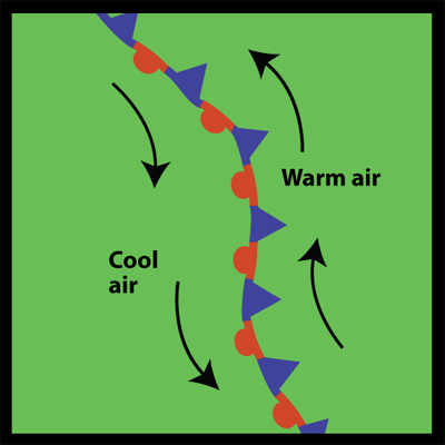
Stationary Fronts
A stationary front typically forms from either a cold or warm front that has stopped moving. This happens when two air masses are pushing against each other but neither is powerful enough to move the other. Winds, which often help move fronts, blowing parallel to the front instead of perpendicular can help the front stay in place.
A stationary front may stay put for days. If the wind direction changes, blowing perpendicular, the front will start moving again, becoming either a cold front or a warm front, or the front may dissipate.
Because a stationary front marks the boundary between two different air masses, there are often differences in air temperature and wind on opposite sides of a front. The weather is often cloudy along a stationary front and rain or snow commonly falls, especially if the front is in an area of low atmospheric pressure.
On a weather map, a stationary front is shown as alternating red semicircles and blue triangles like in the map at the left. The blue triangles point in one direction and the red semicircles point in the opposite direction.
Last modified August 12, 2009 by Lisa Gardiner.
You might also be interested in:

How did life evolve on Earth? The answer to this question can help us understand our past and prepare for our future. Although evolution provides credible and reliable answers, polls show that many people turn away from science, seeking other explanations with which they are more comfortable.
...more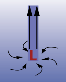
You may have seen a weather map with a red L on it. This red L denotes a low pressure system in that area of the map. Just what does that mean? The H for high pressure systems and alternatively the L for
...more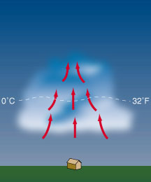
The sun heats the earth's surface during the day. The heat accumulates on the surface and warms the air around it. Since warm air is lighter than cool air, it starts to rise (known as an updraft). If
...more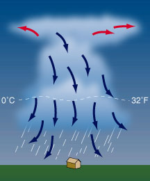
After about 30 minutes, the thunderstorm begins to dissipate. This occurs when the downdrafts in the cloud begins to dominate over the updraft. Since warm moist air can no longer rise, cloud droplets
...more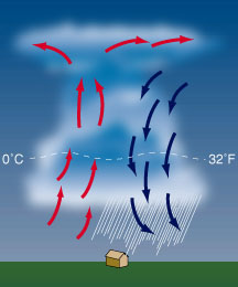
When the cumulus cloud becomes very large, the water molecules in it become large and heavy. They start to fall through the cloud when the rising air can no longer hold them up. Meanwhile, cool dry air
...more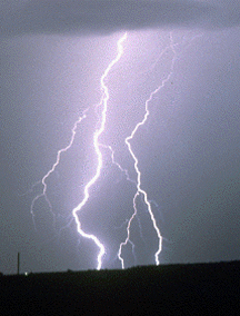
You see a flash of lightning across the night sky. Five seconds later, your hear the rumble of thunder. If lightning and thunder come from the same source, then why don't they occur at the same time?
...more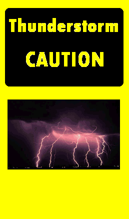
Thunderstorms can be really dangerous! Flash floods, lightning bolts, hail, tornadoes...all of these things can hurt you if you're not careful. So here's some safety tips. GO INSIDE! If you hear distant
...more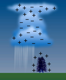
The sky is filled with electric charge. In a calm sky, the positive (+) and negative (-) charges are evenly spaced throughout the atmosphere. Therefore, a calm sky has a neutral charge. Inside a thunderstorm,
...more