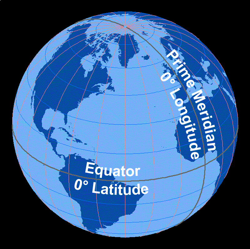
On this image of the Earth, the horizontal (blue) lines represent lines of latitude and the vertical (pink) lines represent lines of longitude. The horizontal gray line represents the equator and the vertical gray line represents the Prime Meridian; both of these lines represent 0 degrees. The North Pole, at the top of the image, is where all of the lines of longitude come together.
Image Courtesy of Dennis Ward/UCAR