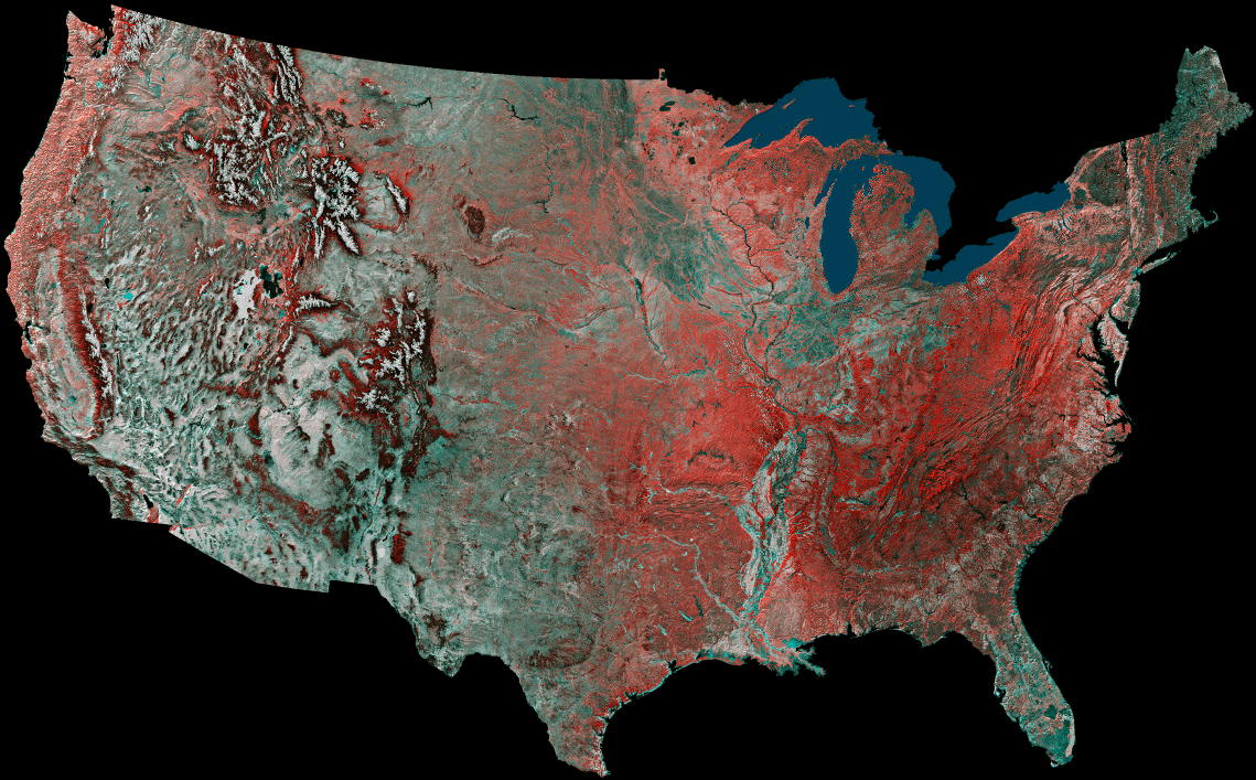
This United States is a mosaic prepared by using 16 images from
the Advanced Very High Resolution Radiometer (AVHRR)
sensors on the meteorological satellites NOAA-8 and NOAA-9. The
images were taken between May 24, 1984 and May 14,
1986. On false-color infrared mosaics, vegetation appears in red
instead of green. The "redness" indicates vegetation density,
type and whether growing on dry land or in a swamp. Grasslands
appear light red, deciduous trees and croplands appear red,
and coniferous forests appear dark red or maroon. Desert areas
appear white and urban areas appear bluish green. Lakes, rivers
and oceans appear in various shades of blue, dark blue for deep
water and light blue for shallow or turbid water.
Courtesy of USGS