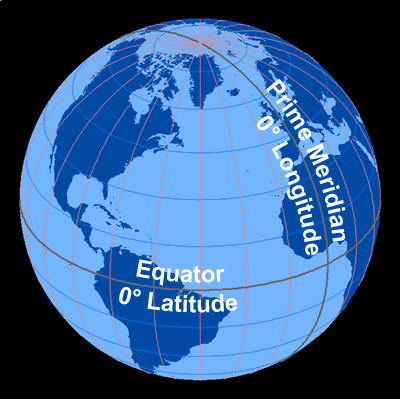
This cutaway view of the Earth shows the angular measurement of latitude and longitude.
Click on image for full size
Image Courtesy of Dennis Ward/UCAR
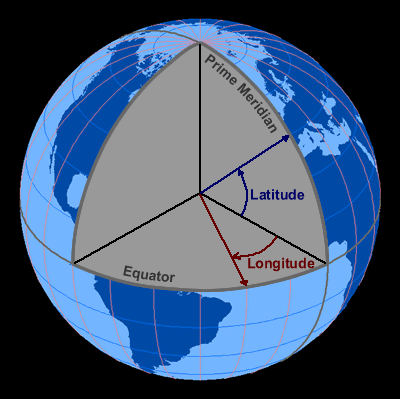
Click on image for full size
Image Courtesy of Dennis Ward/UCAR
Related links:
Angles Determine Latitude and Longitude
This cutaway view of the Earth shows how the measurements of latitude and longitude are found.
Latitude, shown in blue, describes the location of a place north or south of the Equator. Latitude can either be North or South, depending on the hemisphere in which the place is located.
Longitude, shown in red, describes the location of a place east or west from the Prime Meridian. Longitude is described as being either East or West, depending on which way you measure from the Prime Meriadian.
Last modified July 23, 2008 by Becca Hatheway.