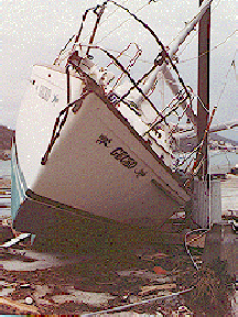
Image courtesy of FEMA
Related links:
Hurricane Bonnie Update
News story originally written on August 25, 1998
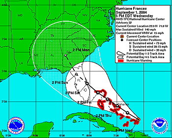
From the National Weather Service, Miami, Florida, 11 a.m. EDT: A hurricane warning remains in effect from Murrels Inlet, South Carolina to the North Carolina/Virgina border...Including Pamlico and Albemarle Sounds. A hurricane watch remains in effect from Savannah, Georgia to Murrells Inlet, South Carolina and from the North Carolina/Virginia border to Cape Henlopen, Delaware...Including the Chesapeak Bay Southward from Windmill Point.Preparations to protect life and property should be rushed to completion in the hurricane warning area. Interests in the watch and warning areas should follow recommendations from their local emergency management officials. The forecast track brings the center near the outer banks of North Carolina late Wednesday morning. Tropical storm force winds are likely to arrive at the coast of South Carolina and North Carolina near midnight and hurricane force winds near dawn Wednesday.
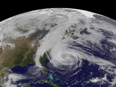
This hurricane is a category 3 storm capable of considerable damage. If this hurricane does reach the U.S. East coast, flooding and high winds could cause a lot of property damage. This hurricane has been very hard to forecast because it is erratic, i.e. it continues to stall overnight and then during the day it continues on its northwest path headed for the East coast.
Here's the tropical update index supported by the Weather Channel.