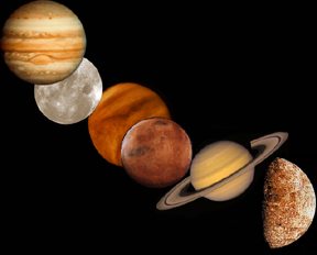
Click on image for full size
Courtesy of NASA
Related links:
Scientists Create 3-D Map of Mars
News story originally written on May 28, 1999
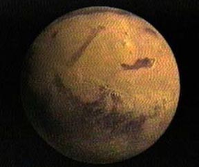
With the help of the Mars Global Surveyor, scientists were able to create a detailed 3-dimensional map of Mars. Using an instrument called Mars Orbiter Laser Altimeter (MOLA), the spacecraft took over 27 million measurements. The largest distance between measurements is 37 miles. Scientists say we know more about the topography of Mars than of Earth.
"This incredible database means that we now know the topography of Mars better than many continental regions on Earth," said Dr. Carl Pilcher, Science Director for Solar System Exploration at NASA Headquarters, Washington, DC. "The data will serve as a basic reference book for Mars scientists for many years, and should inspire a variety of new insights about the planet's geologic history and the ways that water has flowed across its surface during the past four billion years."
One interesting feature found on the red planet is a large basin big enough to swallow Mt. Everest. The basin, which is 6 miles deep and 1,300 miles across, is believed to have been formed by a collision with an asteroid. Surrounding the basin is a sort of ring, made of material that was once in the basin.
However, the most important aspect of the map is the general differences between the Northern and Southern Hemispheres. The Southern Hemisphere is 3 miles higher than the Northern Hemisphere, and has many craters compared to the smooth northern half. The slope that formed between the two halves resulted in a flow of water to the upper hemisphere. The water, which may have had a volume as high as 1.2 million cubic miles, has either evaporated or been absorbed by the planet.
"While water flowed south to north in general, the data
clearly reveal the localized areas where water may have once
formed ponds, " explained Dr. Maria Zuber of the
Massachusetts Institute of Technology, Cambridge, MA, and
Goddard.