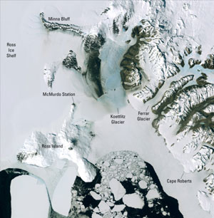
This image of the area around McMurdo Station shows much detail of the ice shelves, mountains, glaciers of Antarctica. It is a fascinating and important place to study.
Click on image for full size
Courtesy of USGS
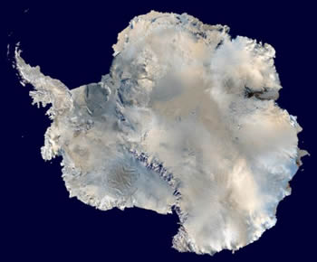
Newly Unveiled Satellite Map of Antarctica Is a Unique Tool for Scientists, Educators and the Public
News story originally written on November 27, 2007
Scientists have made a new map of Antarctica that is going to be a very helpful tool for studying that region. It is called a mosaic map because the map puts thousands of scenes into one map that is has a lot of detailed information.
The map is called LIMA, which is short for the Landsat Image Mosaic of Antarctica. Landsat launches satellites that take digital photographs of the Earth that scientists use to study the Earth's environment.
The LIMA map will be very helpful to scientists and the general public, especially because people today are worried about the polar ice caps and the warming temperatures in the Arctic and Antarctic regions. LIMA will be used to answer scientific questions, and teachers and students will use LIMA to learn more about Antarctica.
Robert Bindschadler, a scientist at NASA, said that LIMA is the most detailed map of Antarctica and offers the most accurate, true-color views of Antarctica that are possible. He compared the LIMA map with the other maps scientists have been using by saying that LIMA is like watching high-definition TV in living color and the other maps are like watching the picture on a small black-and-white television.
You might also be interested in:
What Will You Find There? If you travel to the South Pole, you will find the continent of Antarctica surrounded by the Southern Ocean. The geographic South Pole is marked by a large sign that scientists
...more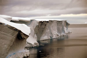
Frozen water is found in many different places on Earth. Snow blankets the ground at mid and high latitudes during winter. Sea ice and icebergs float in the chilly waters of polar oceans. Ice shelves are
...more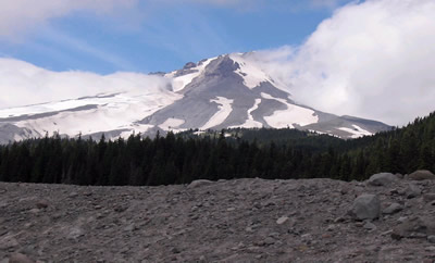
Scientists have learned that Mount Hood, Oregon's tallest mountain, has erupted in the past due to the mixing of two different types of magma. Adam Kent, a geologist at Oregon State University, says this
...more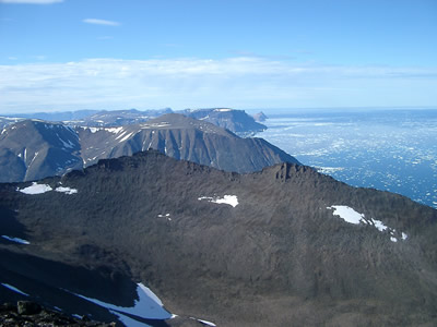
The Earth's mantle is a rocky, solid shell that is between the Earth's crust and the outer core. The mantle is made up of many different reservoirs that have different chemical compositions. Scientists
...more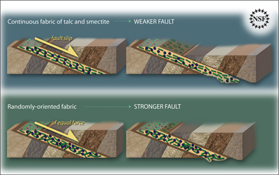
Some faults look strong and like they wouldnt cause an earthquake. But it turns out that they can slip and slide like weak faults causing earthquakes. Scientists have been looking at one of these faults
...more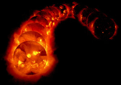
The sun goes through cycles that last approximately 11 years. These solar cycle include phases with more magnetic activity, sunspots, and solar flares. They also include phases with less activity. The
...more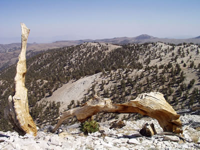
Studying tree rings doesn't only tell us the age of that tree. Tree rings also show what climate was like while the tree was alive. This means that tree rings can tell us about climates of the past. Two
...more