Click on image for full size
Image from: NASA/JPL
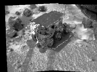
The Mars Pathfinder Landing Site
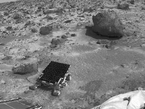
Mars Pathfinder landed in a valley of Mars called Ares Vallis, shown in this picture. Ares Vallis is an outflow plain of Xanthe Terra (check the large topographic map of Mars). The picture to the left is low-resolution and turned sideways. Viewing of the image in high resolution where features can be seen is recommended.
This spot was chosen for the landing site because scientists thought that like Earth, Mars had "flood plains", that is landforms created by the motion of rivers of water where the water carried different kinds of rocks from higher elevations to lower elevations and left them on the plain. Ares Vallis is just such a plain. Thus scientists expected to find many different sorts of rocks to experiment with. Higher elevations from which rock may have come can be seen in selected features around the landing site, some of which are 30 kilometers away, to the south, as viewed in the high resolution image. These outcroppings may be composed of andesite or basalt, both of which are igneous rock. The rocks may also have come from nearby impact craters, to the north, as viewed in the high resolution image.
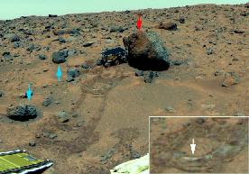
Following the Rover experiments however, the origin of the rocks of the plain became less clear. Reasons that the geology of the landing site may be different than expected include the following:
- the nature of the flood plain, which the Rover observed up close
- the kind of erosion which the various rocks showed evidence of
- the soil which the Rover found
- chemical analysis of the rocks, which shows that they are identical
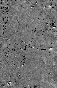
- the presence of nearby impact craters, particularly one called "Big Crater", better seen in the image at high resolution.