Click on image for full size
Courtesy of NASA
The Mariner Missions to Mars
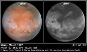
Prior to the Mariner missions, we had to rely on ground-based observations to look at Mars. Using ground-based observations, scientists were able to identify channels, polar caps which varied with season, and a few volcanic features on the surface of Mars. Scientists also speculated about the ferrous nature of the soil of Mars because the surface looked red, just like the surface soils of the southwestern United States.Ground-based observations did not tell us there were clouds, global dust storms, the crevice now called Valles Marineris, and weather on Mars. These observations also didn't tell us the composition of the Martian surface or atmosphere. But, the Mariner missions to Mars would shed light on these topics and much more!
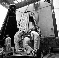
The first of the Martian Mariner missions, Mariner 3, failed to reach Mars. After launch from Earth, a protective shield failed to eject off of Mariner 3. This left all of the instruments covered. The extra weight of the shield prevented the spacecraft from attaining its Mars trajectory. Its sister spacecraft, Mariner 4, was the first successful flyby of the Red Planet. Mariner 4 was launched November 28, 1964, and reached Mars on July 14, 1965. Mariner 4 returned 22 pictures of the Martian surface. The spacecraft's closest approach was at 9912 kilometers.
Mariner 6 and 7, both launched in 1969, completed the first successful dual mission to Mars (Mariner 5 was sent to Venus). Mariner 6 and 7 were identical spacecraft sent to flyby Mars in order to collect data about the surface and atmosphere of Mars. Together, they returned over 200 images of the Martian surface. Most famously, Mariner 7 took the first close-up images of the deep valley, which now bears its name, Valles Marineris.
Mariner 8 was the next planned Martian Mariner mission. This spacecraft was suppose to complete another flyby of Mars. Unfortunately, when the spacecraft was launched in 1971, it failed to reach orbit. The booster Mariner 8 was attached to failed, causing the spacecraft to fall back through the Earth's atmosphere about 560 km north of Puerto Rico.
The last of the Martian Mariner missions was Mariner 9. Mariner 9 was the very first orbiter of Mars to reach Mars. During its year in orbit around Mars, it returned more than 7,329 images. These images provided the first global mapping of Mars. Mariner 9 also took the first detailed pictures of moons Phobos and Deimos.
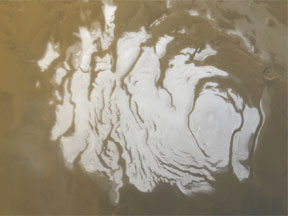
Together the Mariner missions to Mars took the first images of the volcanoes of Mars, including Olympus Mons, and others atop the Tharsis Ridge. These were the first missions to show us the south polar region. The Mariner missions also measured the moment of inertia of Mars, made the first determination of the Martian bulge now called Tharsis Ridge, and made a record of the surface dichotomy of old, elevated, northern terrain and young, low, southern terrain.
The Mariner missions helped establish that, like the Moon, Mars had a barren surface with no running water. The vast number of craters helped establish that the surface of Mars was young compared to that of the Moon or Mercury, but nevertheless, very old when compared to that of the Earth.
The next American spacecraft to visit Mars were the Viking missions.


