MILAGRO Image Gallery


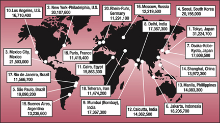
This map shows the world's 20 most populous urban agglomerations in 2004. With 21,503,000 inhabitants, Mexico City ranks third. ( Data courtesy of the World Gazetteer; illustration courtesy of Mike Shibao, UCAR.)
( 147K JPG)


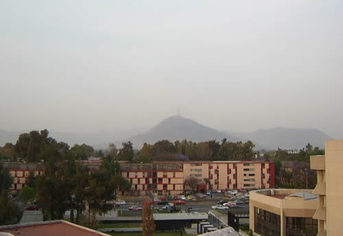
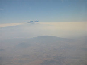
MILAGRO takes place in Mexico City, the capital of Mexico and one of the largest cities in the world with approximately 22 million inhabitants. Prevailing winds usually blow the city's air pollution to the northeast in a plume that extends over the Gulf of Mexico.
( 437K JPG)


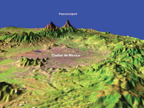
This is a computer generated 3-D rendering of the landscape surrounding Mexico City.
( 105K JPG)


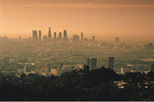
Air pollution over Mexico City ( Photo courtesy of Nancy A.Marley)
( 21K JPG)


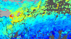
This satellite image from MOPITT shows air pollution over China and Southeast Asia during January 2003. ( Image courtesy of the NCAR MOPITT team)
( 99K JPG)


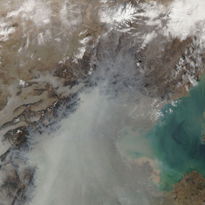
Satellite image of particulate pollution over Beijing, China. ( NASA image courtesy the MODIS Rapid Response Team)
( 219K JPG)


Ozone peaks in urban areas during late afternoons. ( Courtesy of UCAR)
( 24K JPG)


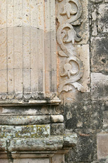
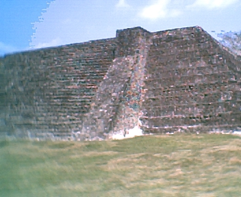
This building in Copola, Mexico, has been damaged by acid rain. ( Courtesy of UCAR Digital Image Library)
( 159K JPG)


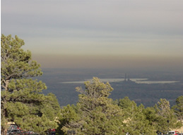
An inversion layer hangs over residents of Boulder, Colorado. ( Source: T. Eastburn)
( 147K JPG)


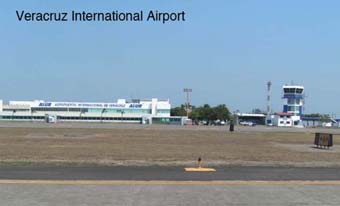
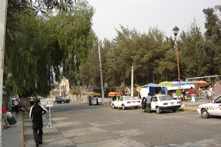
This is a photo of the Veracruz International Airport. ( Courtesy of UCAR)
( 52K JPG)


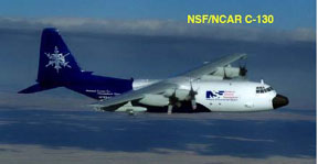
This is a photo of the C-130 airplane. ( Courtesy of UCAR)
( 36K JPG)


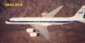
This is a photo of the DC-8 airplane. ( Courtesy of NASA)
( 64K JPG)


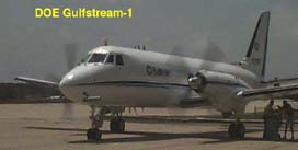
This is a photo of the Gulfstream airplane. ( Courtesy of the DOE)
( 50K JPG)


This is an image of the J-31 airplane. ( Courtesy of NASA)
( 42K JPG)


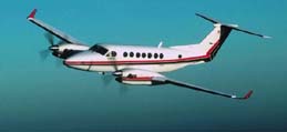
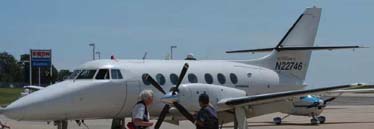
This is a photo of the King Air plane. ( Courtesy of the DOE)
( 42K JPG)


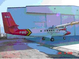
This is a photo of the Twin Otter plane. ( Courtesy of the US Forest Service)
( 15K JPG)


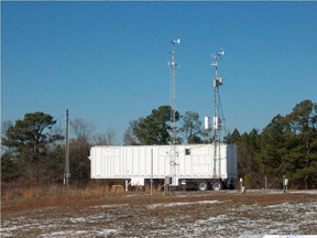
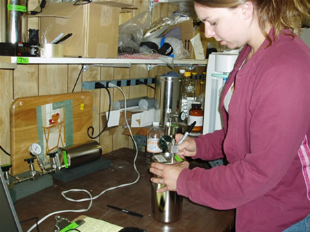
This is a photo of a mobile lab. ( Courtesy of Georgia Institute of Technology)
( 196K JPG)


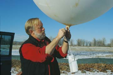
A scientist prepares to launch a radiosonde. ( Courtesy of the Digital Image Library, UCAR)
( 512K JPG)


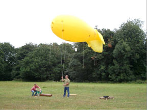
Researchers with a tethersonde. ( Courtesy of the DOE)
( 121K JPG)


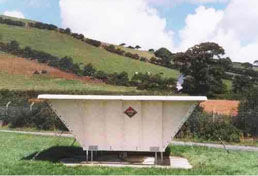
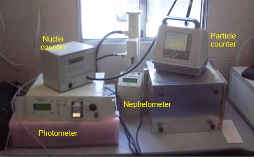
Wind profilers such as this one will help MILAGRO researchers measure wind speed and direction. ( Courtesy of NSF)
( 49K JPG)


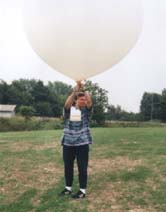
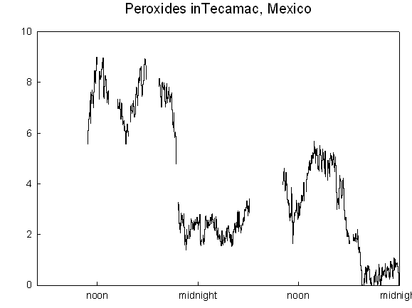
A scientist prepares to launch a balloon with an ozonesonde and radiosonde attached. The dual instruments will collect ozone and weather information at heights up to 115,000 feet (35 km). ( Source: MILAGRO Image File)
( 62K JPG)

You might also be interested in:

Cool It! Game

Check out our online store - minerals, fossils, books, activities, jewelry, and household items!...more

Greetings from the Tecamac Technical University Site

It’s been two weeks since we arrived in Mexico and it’s been a real challenge to recreate our laboratory in a trailer in the field in this desert-like location – Tecamac – north of the Federal District...more

Light extinction of particles

Not all particles are the same, many of them have different shape, size, and composition. Some of them reflect or scatter light, and others absorb it. Two instruments on the image, photometer and nephelometer,...more

Introduction to Milagro

One of the most complex field campaigns ever undertaken in the field of atmospheric chemistry began in March 2006. A team of researchers from around the world is in Mexico City for a series of projects...more

What does Tecamac mean?

Measuring site T1 is in Tecámac. This is a little town close to Mexico City. The name Tecámac is a Náhuatl word, an ancient Mexico's language, spoken by Aztecs. In Náhuatl, Tetl or Tec means stone, camatl...more

Peroxides Measured at the T1 Site

Hello again: We are nearing the end of our field campaign in Mexico. It has been a real adventure, with friendly people, great food, and interesting science. I obtained some good hydrogen peroxide measurements...more

Cerro del Chiquihuite

Here is an example of how polluted the City is. This is a picture of "Cerro del Chiquihuite", which is situated around 5km (3miles) north from us. Chiquihuite is very close, indeed. However, we can barely...more

Ruins at Zempoala

On one of our down days, we took a little trip to a small town about 20 km from Veracruz. In the little town of Zempoala (also called Cempoala), there is a large area of partially restored ruins of ancient...more

Windows to the Universe, a project of the National Earth Science Teachers Association, is sponsored in part is sponsored in part through grants from federal agencies (NASA and NOAA), and partnerships with affiliated organizations, including the American Geophysical Union, the Howard Hughes Medical Institute, the Earth System Information Partnership, the American Meteorological Society, the National Center for Science Education, and TERC. The American Geophysical Union and the American Geosciences Institute are Windows to the Universe Founding Partners. NESTA welcomes new Institutional Affiliates in support of our ongoing programs, as well as collaborations on new projects. Contact NESTA for more information. NASA ESIP NCSE HHMI AGU AGI AMS NOAA