

Check out resources from our Affiliates!
Global locations of visitors using this page right now
Welcome to Windows to the Universe - your portal to discovery! Explore the wealth of information available here to learn about the Earth and Space sciences and related topics in the humanities including mythology, art, poetry, and more.
Our mobile website version is available now on your phone's web browser and give us feedback.NEW Subscription Opportunities for Educators and their Students! - Classroom, School, and District Subscription Options.
Windows to the Universe Professional Development - On-site, in your school - find out more about this opportunity here. Information about our upcoming workshops and events is available on our Teacher Resources/Workshops page.
What's New on the Site?
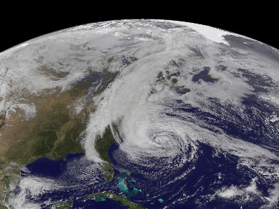
When Nature Strikes - Earthquakes
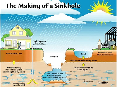
When Nature Strikes - Volcanoes
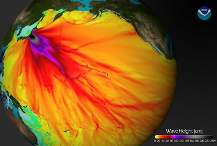
When Nature Strikes: Tsunami Classroom Activity
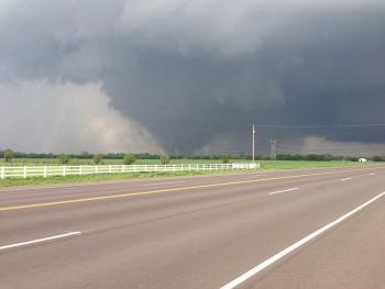
When Nature Strikes: Wildfires - Why are they a challenge to stop?
Windows to the Universe Community | |
News | Opportunities |


Video About Ocean Dead Zones
Oceanographers are using robotic undersea "gliders" to study "dead zones" in the seas. View this video from the National Science Foundation ...Read moreBrought to you by NSF
Clouds in Art
Landscape painters have been representing clouds in their art for centuries. Different artists with different styles have painted clouds differently. Check out the Clouds in Art Interactive ...Read moreBrought to you by CMMAP

The Sun Today
Live and recent images of the Sun from telescopes around the world and satellites in space. Spanning the spectrum from X-rays to infrared images, these views reveal sunspots, solar flares, and ...Read moreBrought to you by CISM
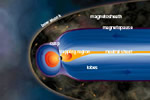
The Earth's Magnetic Field
The magnetic field of the Earth is surrounded in a region called the magnetosphere. The magnetosphere prevents most of the particles from the sun, carried in solar wind, from hitting the Earth ...Read more
Historical Events
Full Earth and Space Science History Calendar (Members only)
Teacher Opportunities
Full Teacher Events Calendar (Educator Members only)
Buried Treasure!
Trans-Neptunian Objects (TNO)
There are many icy and rocky planetoids on the outer edge of our Solar System. As a group, all bodies...Read more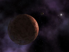
Please log in
Science Blogs
Real Climate: climate science from climate scientists

Windows to the Universe, a project of the National Earth Science Teachers Association, is sponsored in part is sponsored in part through grants from federal agencies (NASA and NOAA), and partnerships with affiliated organizations, including the American Geophysical Union, the Howard Hughes Medical Institute, the Earth System Information Partnership, the American Meteorological Society, the National Center for Science Education, and TERC. The American Geophysical Union and the American Geosciences Institute are Windows to the Universe Founding Partners. NESTA welcomes new Institutional Affiliates in support of our ongoing programs, as well as collaborations on new projects. Contact NESTA for more information.
