Click on image for full size
Courtesy of USGS (United States Geological Survey
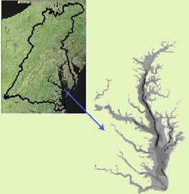
Chesapeake Bay
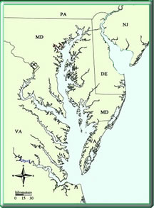
Chesapeake Bay is the largest of 130 estuaries in the United States. Rivers, streams and ground water drain into Chesapeake Bay where this fresh water mixes with the salt water from the Atlantic Ocean. This mixing of fresh water and salt water is what makes this an estuary.Chesapeake Bay is shallow. It is only 21 feet deep on average. The Bay stretches from Havre De Grace, Maryland, to Norfolk, Virginia. The Bay itself is about 200 miles long, but the Bay along with its tributaries has a shoreline that measures approximately 11,684 miles in total. The Bay is very narrow at points (only 3.4 miles across near Aberdeen, Maryland). The Bay's widest point is 35 miles across near the mouth of the Potomac River.
The Chesapeake Bay watershed is large. It covers approximately 64,000 square miles and includes parts of six states, New York, Pennsylvania, Delaware, Maryland, Virginia, and West Virginia, and all of the District of Columbia. The black line superimposed on the satellite image to the left marks the boundry of the Chesapeake Bay watershed.
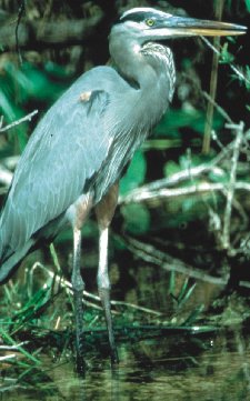
Estuaries are unique places where life thrives! Chesapeake Bay is no exception! The Bay watershed is home to more than 3,600 species of plants and animals. Plant and animal populations in the Bay water vary with changes in clarity, dissolved oxygen, salinity, temperature and human impacts to the water. After all, the watershed is also home to 15.1 million people.
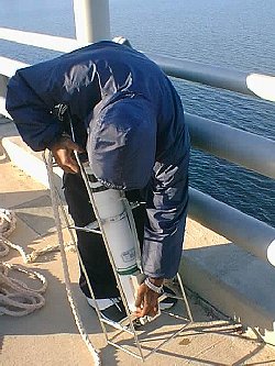
Humans have a huge effect on the water quality of Chesapeake Bay. According to the Chesapeake Bay program, " each time a person uses electricity, drives a car or even drops a piece of trash, a chain of events that can affect the Bay occurs. Today, the biggest stressors on the ecosystem are excess nutrients, toxic/chemical contamination, air pollution and landscape changes." Organizations such as the Chesapeake Bay program are trying to boost awareness of human impacts on the Bay area. They are also trying to get people involved in restoring the Bay. Along the lines of restoring and studying the Bay as a system, there are many universities, companies and schools taking measurements of the water in the Bay. One such program is the HIGH TIDE program that involves area high schools that are making measurements of the water in the Bay in order to note changes in salinity, temperature and density.