15 of the Moai on Easter Island.
Click on image for full size
Image Courtesy of the Wikipedia Commons

Easter Island

Easter Island, also known as Rapa Nui, is a volcanic island located in the Southeast Pacific Ocean. It was given the name "Easter Island" when a Dutch explorer visited the island on Easter Sunday in 1722.

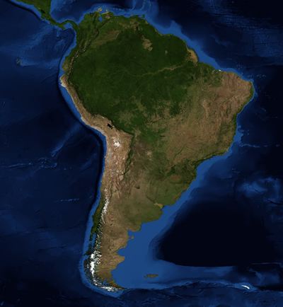
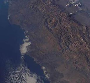
Easter Island is located far from other islands or continents. Chile is 3,600 km (2,237 miles) to the east and Tahiti is 3,200 km (2,000 miles) to the west. This small island is shaped like a triangle. There is an extinct volcano at each corner. Craters in the volcanoes contain water, and the rest of the island is covered by grasslands and ancient lava flows. Easter Island has a subtropical climate.

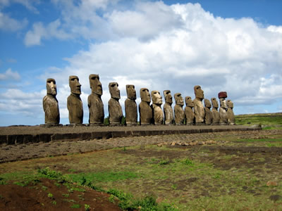
Easter Island is well-known because of the 887 large stone statues created by the Rapa Nui people. They created these statues, called moai, as a way to worship their ancestors. In the 1500s the Rapa Nui people began to create petroglyphs of the bird-man cult. The Rapa Nui population dropped because of warfare on the island, slave raids from the mainland of South America, and exposure to European diseases. Approximately 2,300 Rapa Nui people live on Easter Island today.

People visit Easter Island to view the moai. The moai are now part of a national park and have been designated a World Heritage Site by UNESCO.

Last modified September 18, 2008 by Becca Hatheway.

You might also be interested in:

The Southeast Pacific Region

The Southeast Pacific region is a very diverse part of South America. It includes coasts along the ocean and the Andes mountains in Chile and Peru. The climate of the Southeast Pacific is influenced by...more

Angles Determine Latitude and Longitude

This cutaway view of the Earth shows how the measurements of latitude and longitude are found. Latitude, shown in blue, describes the location of a place north or south of the Equator. Latitude can either...more

Latitude and Longitude

The most common way to locate points on the surface of the Earth is by using lines on a map or globe called lines of latitude and longitude. Latitude describes the location of a place north or south of...more

The Andes Mountains

The Andes Mountains are one of the longest mountain ranges on Earth. This mountain range is over 7,000 km (4,400 miles) long and runs along the west coast of South America. The Andes include peaks above...more

Windows to the Universe, a project of the National Earth Science Teachers Association, is sponsored in part is sponsored in part through grants from federal agencies (NASA and NOAA), and partnerships with affiliated organizations, including the American Geophysical Union, the Howard Hughes Medical Institute, the Earth System Information Partnership, the American Meteorological Society, the National Center for Science Education, and TERC. The American Geophysical Union and the American Geosciences Institute are Windows to the Universe Founding Partners. NESTA welcomes new Institutional Affiliates in support of our ongoing programs, as well as collaborations on new projects. Contact NESTA for more information. NASA ESIP NCSE HHMI AGU AGI AMS NOAA