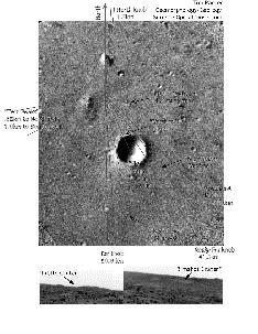
This image shows the landing site for the Mars Pathfinder mission.
Click on image for full size
Image from: NASA/JPL
The Flood Plain explored by Mars Pathfinder
The nature of the flood plain observed by the Rover was unusual compared to a terrestrial flood plain, and suggested that it might not actually be a floodplain. The rocks could have come from ejecta from impacts which created the nearby craters. Scientists have to consider all the evidence before them so that they can prove a hypothesis is true.
Scientists discovered many pebbles, cobbles and conglomerate-type rocks. These suggest that the landingsite *was* formed from outflowing water.
Scientists considered carefully whether the origin of the rocks could be from flowing water or from impact processes. Findings from these studies contribute to the overall results of the Pathfinder mission, and help answer some questions.
You might also be interested in:
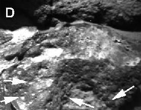
This image shows pits and holes in a small rock found by the Mars Pathfinder Rover. The Souffle rock also reveals a very pitted surface. These pits and holes are the result of sand caught up in the winds
...more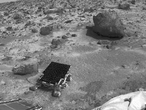
These are the findings of Mars Pathfinder. Rounded Pebbles were found - a result from analysis of the landing site, the rocks, and the soils. there were a variety of rocks deposited by a catastrophic flood
...more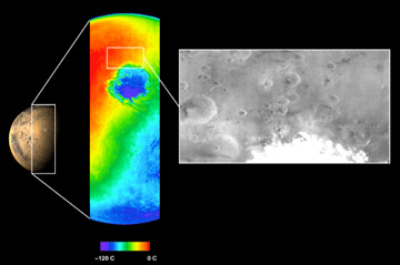
The Mars Odyssey was launched April 7, 2001. After a six-month journey, the Odyssey arrived at Mars on October 24, 2001. The instruments onboard the Mars Odyssey will study the minerals on the surface
...more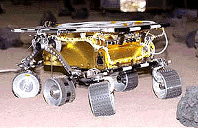
The Mars 2005 mission is still in the planning stages. It is set to launch in the year 2005.
...more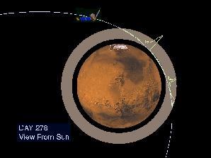
Aerobraking slowed the Mars Global Surveyor down when it reached Mars. Aerobraking also helped MGS to get into the right orbit for mapping the surface of Mars. Aerobraking means that the MGS flew through
...more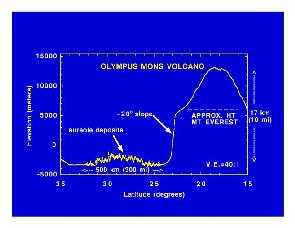
Mars Global Surveyor carries an instrument which measures the heights of things. This instrument is called an altimeter, or "altitude-meter". The graph to the left shows the results returned from Mars
...more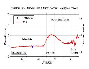
Mars Global Surveyor carries an instrument which measures the heights of things. The picture to the left shows Mars Global Surveyor's measurement of the size of the giant cliff which separates the southern
...more