Thunderstorm Image Gallery
Click on images for full size.
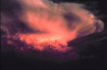 |
This thunderstorm was seen at sunset near Abilene, Texas on May 17, 1978. Courtesy of NOAA Photo Library, NOAA Central Library; OAR/ERL/National Severe Storms Laboratory (NSSL) |
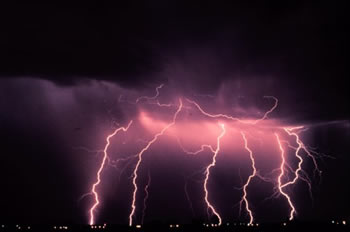 |
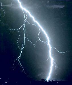
This image of multiple cloud-to-ground lightning strokes was taken during a night time thunderstorm in Norman, Oklahoma in March 1978. Courtesy of NOAA Photo Library, NOAA Central Library; OAR/ERL/National Severe Storms Laboratory (NSSL) |
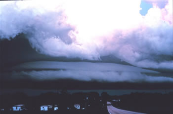 |
During this 1982 thunderstorm, when the rain-cooled air moved out ahead of the storm, it went under warm moist air, creating a shelf cloud. Notice the bright light blue sky at the top of the picture and the dark gray-black color of the sky below. Courtesy of NOAA Photo Library, NOAA Central Library; OAR/ERL/National Severe Storms Laboratory (NSSL) |
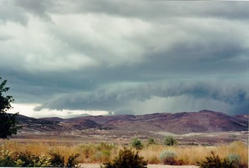 |
A severe thunderstorm in the distance over Elko, NV. Courtesy of National Weather Service Forecast Office of Elko, NV |
 |
This thunderstorm, including a shelf cloud out in front, moved into Rockfish, NC on June 27, 2006. Courtesy of National Weather Service Forecast Office of Rayleigh/ Jewell Chambers |
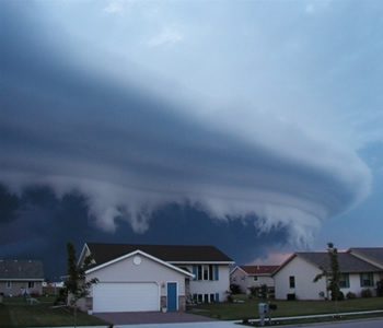 |
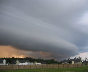
This thunderstorm shows a shelf cloud that passed over Little Chute, WI on June 13, 2004. Courtesy of National Weather Service Forecast Office of Green Bay, WI/ Brian Severa |
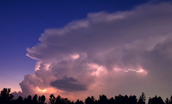 |
Notice the lightning that is part of a thunderstorm that was seen in Menomonee Falls, WI on July 3, 2001. Courtesy of National Weather Service Forecast Office of Milwaukee/ Chris VenHaus |
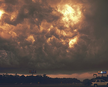 |
This photo of a thunderstorm shows large bursts of lightning in the cloud. It was seen in South Milwaukee, WI on August 1, 2002. Courtesy of National Weather Service Forecast Office of Milwaukee/ Brian Larmay |
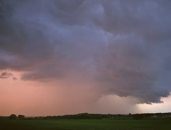 |
This thunderstorm happened on June 10, 2003 in Watertown, WI. The faded area underneath the cloud shows the rain that is falling from the storm. Courtesy of National Weather Service Forecast Office of Milwaukee/ Brian Larmay |
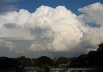 |
In 2005, this large cumulonimbus cloud produced a thunderstorm that was seen over Lake Superior. Courtesy of National Weather Service Forecast Office of Marquette, MI/ Don Rolfson & Bryan Mroczka |
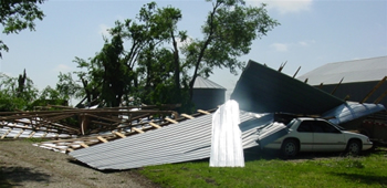 |
This image shows the damage to a building from a thunderstorm that moved through Southern Osage County in Kansas on May 18, 2005. Courtesy of National Weather Service Forecast Office of Topeka, KS |
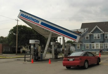 |
A gas station canopy fell over after a thunderstorm with 60 mph winds came through Green Bay, WI on July 30, 2006. Courtesy of National Weather Service Forecast Office of Green Bay |

 Images and Multimedia on Windows to the Universe
Last modified July 24, 2008 by Vanessa Pearce.