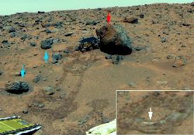
The Shark.
Click on image for full size
Image from: JPL/NASA
The Shark
The slanted rock shown here was named The Shark. The Shark, Half Dome, and Moe are rocks which, because of their slant, seemed to indicate that a heavy flow took place at one time in the area, and deposited a host of boulders. The Shark was a bright rock. X-ray spectra of the Shark indicated that it also may be a special kind of basaltic (igneous) rock called an andesite.
Examination of the Shark contributed to the overall results of the Mars Pathfinder mission by providing evidence that there may have once been flowing water. Other evidence of the past existence of flowing water came in the form of rounded pebbles, and conglomerates. These bits of evidence helped scientists pinpoint the possible origin of the rocks.
You might also be interested in:
Even though the rocks seem to be much the same, scientists can see three basic differences in these rocks. These differences help them figure out more about weathering processes on Mars and where the soils
...more
Basalt is an extrusive igneous rock that is very dark in color. It is the most common type of rock in the Earth's crust and it makes up most of the ocean floor. It is made of many dark colored minerals
...more
These are the findings of Mars Pathfinder. Rounded Pebbles, Cobbles and possible Conglomerates were found - a result from analysis of the landing site, the rocks, and the soils. showed that there were
...more
This image shows pits and holes (ventifacts) in a small rock found by the Mars Pathfinder Rover. These ventifacts are artifacts of weathering on Mars and were created by wind erosion. The Souffle rock
...more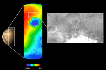
The Mars Odyssey was launched April 7, 2001, from Florida. After a six-month, 285 million-mile journey, the Odyssey arrived at Mars on October 24, 2001. The Odyssey is in its aerobraking phase right now.
...more
The Mars 2005 mission is still in the planning stages. It is set to launch in the year 2005.
...more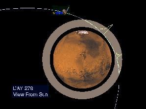
The Mars Global Surveyor reached Mars in September of 1997. But it didn't make it into its final mapping orbit until February 1999. What took so long? Surveyor needed to reach a near-circular, low-altitude
...more