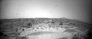
This is a picture of sand dunes seen by Mars Pathfinder.
Click on image for full size
Image from: NASA/JPL
Martian Duneforms
There are many portions of surface near the Mars Pathfinder landing site covered by equal-sloped, dune-like ridges, as shown in this picture, which are oriented transverse to the wind direction. These dunes consist of particles placed in motion by the mechanism of saltation.
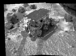
During the Rover's exploration of the Martian surface, it traversed what scientists now call the "Mermaid Dune", covered with soils.
Analysis of the soils at Mermaid Dune, as well as study of other winddrifts seen near the landing site contributed to the overall understanding of the weathering processes near the landing site.
You might also be interested in:
One of the measurement objectives of the Mars Pathfinder mission was the examination of the composition and structure of the soil. As the Rover traversed the surface exploring the rocks of Mars, it also
...more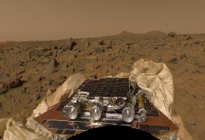
The Mars Pathfinder (MPF) mission was sent to investigate the geology of Mars. Its principal objective was to analyze the rocks and soil of Mars. The MPF consisted of 2 components, a lander and a mobile
...more
The Mars Odyssey was launched April 7, 2001, from Cape Canaveral Air Force Station in Florida. After a six-month, 285 million-mile journey, the Odyssey arrived at Mars on October 24, 2001 (02:30 Universal
...more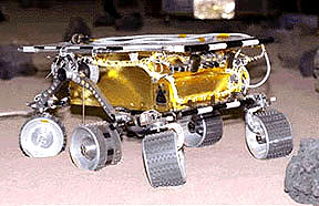
The Mars 2005 mission is still in the planning stages. It is set to launch in the year 2005.
...more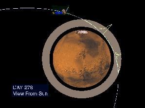
On September 12, 1997, the Mars Global Surveyor successfully entered a highly elliptical orbit around Mars. To get into the near-circular, near-polar, low-altitude orbit necessary to map the surface of
...more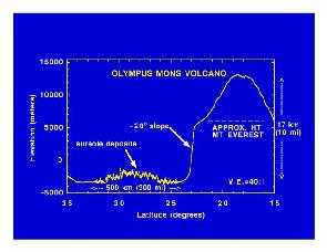
Mars Global Surveyor carries an instrument which measures the altitudes of things. The instrument is called an altimeter, or "altitude-meter". The graph to the left shows the results returned from Mars
...more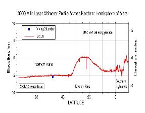
Mars Global Surveyor carries an instrument which measures the altitudes of things. The instrument is called an altimeter, or "altitude-meter". The graph to the left shows Mars Global Surveyor's measurement
...more