

Image courtesy of Janine Goldstein | ||||
| ||||
You might also be interested in:

Traveling Nitrogen Classroom Activity Kit
Check out our online store - minerals, fossils, books, activities, jewelry, and household items!...more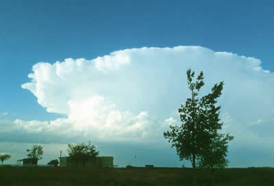
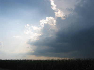
Thunderstorms
Thunderstorms are one of the most thrilling and dangerous types of weather phenomena. Over 40,000 thunderstorms occur throughout the world each day. Thunderstorms form when very warm, moist air rises into...more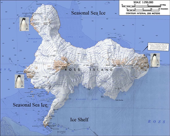
Penguin Colonies
This is Ross Island, a volcanic island embedded in the Ross Ice Shelf, Antarctica. Adelie penguins are found all around Antarctica, but we will be filming the documentary at the breeding colonies shown...more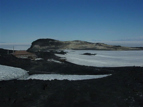
View from our home
This is a view of the Adelie penguin breeding colony at Cape Royds in Antarctica. In the foreground you see Shackletons hut. Sir Ernest Shackleton and his team of explorers tried and failed to cross the...more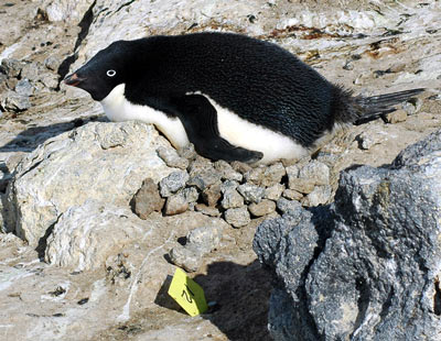
Time to Raise the Chicks
We are at Cape Royds, Ross Island, Antarctica, a penguin breeding colony of several thousand Adelie penguins. This female is 8 years old and has been a successful breeder in the past. She was first seen...more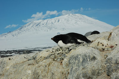
Ice, Fire, and Penguins
Cape Royds penguin breeding colony is in the shadow of Mt Erebus, one of three volcanoes on Ross Island and the only active one. Antarctica Explorer James Clark Ross named two of the volcanoes after his...more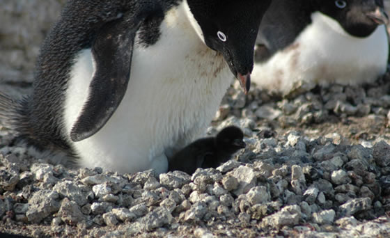
Proud Parents
At long last the moment we have been waiting for, the first Adelie chick of the season. We have been scanning nest sites for broken egg shells, evidence that a chick has hatched. On Dec 12, 2006 we sighted...more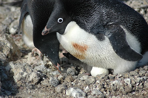
A Family of Penguins
Chicks are hatching everyday now and the colony is bubbling with new life. The air is filled with the songs of penguins returning from feeding and the growls of predatory Skua birds as they circle the...morePlease log in
Science Blogs
Real Climate: climate science from climate scientists

Windows to the Universe, a project of the National Earth Science Teachers Association, is sponsored in part is sponsored in part through grants from federal agencies (NASA and NOAA), and partnerships with affiliated organizations, including the American Geophysical Union, the Howard Hughes Medical Institute, the Earth System Information Partnership, the American Meteorological Society, the National Center for Science Education, and TERC. The American Geophysical Union and the American Geosciences Institute are Windows to the Universe Founding Partners. NESTA welcomes new Institutional Affiliates in support of our ongoing programs, as well as collaborations on new projects. Contact NESTA for more information.
