Venus Image List
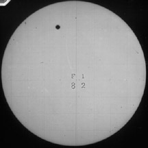
This is a movie of Venus rotating.

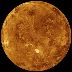
This is a global view of the surface of Venus compiled from Magellan's radar mapping results. The image is centered at 0 degrees east longitude. Simulated hues are based on color photographs taken by Venera 13 and 14. (Courtesy of NASA/JPL)
(139K GIF)

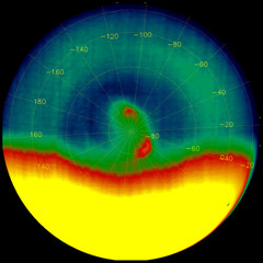
This is a hemispheric view of Venus color-coded to represent elevation. (Courtesy of NASA/JPL)
(343K GIF)

This is an image of clouds on Venus. (Courtesy of Aris Multimedia Entertainment, Inc. 1994)
(149K GIF)
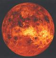
This is a hemispheric view of Venus. (Courtesy of NASA)
(49K JPG)

This image is a composite of the complete radar image collection obtained by the Magellan mission. It shows craters on the surface of about 300 to 500 million years old. (Courtesy of NASA/JPL)
(95K GIF)

This is an image of filtered topography of Venus from the Pioneer Venus spacecraft.
(266K GIF)
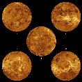
These are five surface views of Venus. The center image is centered at the north pole. The other four images are centered around the equator of Venus. (Courtesy of NASA/JPL)
(111K GIF)
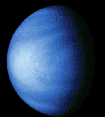
The blue color of this image is used to show contrasts in cloud patterns. This image was taken with a violet filter. (Courtesy of NASA)
(52K GIF)

This is another false color image of Venus seen by the SSI instrument on Galileo. (Courtesy of NASA)
(52K JPG)

This is a topographic map of Venus on a sinusoidal map. (Courtesy of NASA)
(148K JPG)
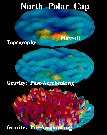
This is an image showing gravity comparisons on Venus. (Courtesy of NASA/JPL)
(34K GIF)
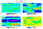
This image shows Venus surface gravity from Magellan.
(146K GIF)
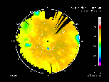
This image shows Venus brightness temperature. (Horizontal Polarization)
(165K GIF)
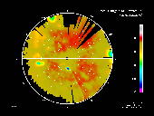
This image shows Venus brightness temperature (Vertical polarization)
(147K GIF)

This is a close-up 3-D image of the surface.
(206K GIF)

This is a 3-D image of three craters on Venus. (Courtesy of NASA/JPL)
(298K GIF)

This is an image of a crater on Venus with multiple rings that rise above the crater floor. (Courtesy of NASA)
(12K GIF)
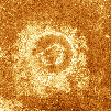
This is an example of a crater with an outer rim and a circular arrangement of inner peaks and ridges.(Courtesy of NASA)
(190K GIF)
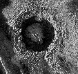
This is an image of the Dickinson Crater taken by Magellan. (Courtesy of NASA/JPL)
(312K GIF)

This is a 3-D image of surface of Venus by Magellan. (Courtesy of NASA)
(195K GIF)

This is a 3-D image of the highland of Ovda Regio on Venus. This is a computer generated image from the radar data on Magellan. (Courtesy of NASA/JPL)
(151K GIF)

This is another image of the same region on Venus. (Courtesy of NASA/JPL)
(153K GIF)

This is an image of the Akna Mountain. (Courtesy of NASA)
(48K GIF)
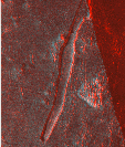
This is a 3-D image of the Lada Terra Region. (Courtesy of NASA)
(252K GIF)
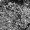
This is an image of ridges and trough. (Courtesy of NASA)
(126K GIF)
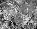
This is a very detailed image of Lada Regio. (Courtesy of NASA)
(322K JPG)

This is a 3-D image of part of the Western Eistla Regio, Lava flows extend for hundreds of kilometers across the fractured plains shown in the foreground. (Courtesy of NASA/JPL)
(251K GIF)

This is a view of three volcanoes in the southern hemisphere of Venus. The colors represent elevation with red the highest and blue the lowest. (Courtesy of NASA/JPL)
(227K GIF)

This is a Magellan radar image of the Ushas Mons volcano in the southern hemisphere of Venus. It is 2 kilometers high. (Courtesy of NASA/JPL)
(179K GIF)
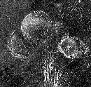
This image shows three unusual volcanoes located in the Guinevere Planitia lowland. These volcanoes are believed to be the result of relatively thick lava flows that originated from a point source. (Courtesy of NASA/JPL)
(299K GIF)

This is a 3-D image of the Sif Mons volcano. (Courtesy of NASA)
(23K JPG)

This is another image of a volcano on Venus (Courtesy of Aris Multimedia Entertainment, Inc. 1994)
(239K GIF)
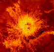
This is an image of the Sapas Mons volcano located in the broad equatorial rise known as Atla Regio. The volcano is about 1.5 kilometers high and 400 kilometers across.(Courtesy of NASA/JPL)
(174K GIF)

This is an ultraviolet image of Venus taken by the Hubble Space Telescope on March 21, 1995. (Courtesy of NASA)
(24K JPG)

This is a radar mosaic from Magellan which shows a portion of a channel. Channels are common on the plains of Venus. (Courtesy of NASA/JPL)
(61K GIF)
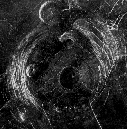
This is a radar image of a region in a vast plain to the south of Aphrodite Terra. The large circular structure near the center is a corona, about 200 kilometers in diameter, named Aine Corona. It is one of the flat-topped volcanic constructs known as "pancake" domes for their resemblance to pancakes. (Courtesy of NASA/JPL)
(227K GIF)

This is an image of two pairs of overlapping volcanic domes located southwest of Alpha Regio on the plains of Tinatin Plantia. (Courtesy of NASA)
(157K GIF)
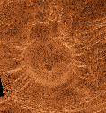
This is an image of a dome located in the Eistla Region. This volcanic dome, often called a "tick", is about 35 km across and has radial ridges which make the dome resemble a bottle cap. (Courtesy of the NASA)
(128K GIF)

This is a view of the surface from the Russian Venera spacecraft.
(815K GIF)
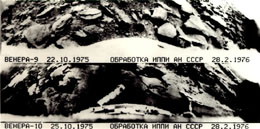
These are images taken by the Russian spacecraft, Venera 9 and 10. The lander portions of Venera 9 and 10 parachuted to the surface of Venus and took the first black and white photos of the surface of Venus. (Courtesy of NASA)
(130K JPEG)

This image was taken by the Russian Venera 13 spacecraft. Venera 13 was the first spacecraft to take a color photo of the surface of Venus. This photo shows what was seen by Venera 13 off the right side of the spacecraft. (Courtesy of NASA)
(76K GIF)

These images show the view from the Russian Venera 14 spacecraft. Venera 14 sampled the soil where it landed, and found a type of basalt also common on Earth. (Courtesy of NASA)
(157K JPG)
Go back to these image archives: Mars , Pluto, Mercury, Saturn, Neptune, Venus , Moon , Earth, Asteroids, Comets, Sun , Missions, Uranus, Astrophysical Objects Mariner, Viking, Mars Pathfinder, Mars Global Surveyor


