Click on image for full size
Image Courtesy of Kimberly Comstock/University of Washington
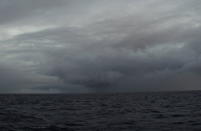
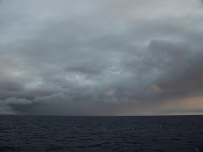
Clouds and Precipitation in the Southeast Pacific
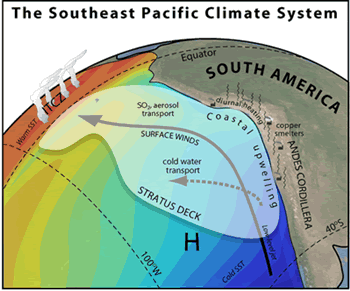
The cold sea surface temperatures and warm, dry air of the Southeast Pacific region create the perfect conditions for the formation of the low stratocumulus clouds that are found in this region. These clouds make up the world's most extensive sheet of stratocumulus clouds, extending for almost 2,000 kilometers (1,243 miles) off the west coast of South America from central Chile to the equator. Stratocumulus clouds that form over the ocean provide shade that helps keep the ocean waters cool. In turn, the cool ocean waters help form the clouds. In addition, aerosols that are produced naturally, and by human activity, are thought to change the amount of shade produced by these marine stratocumulus clouds.
Like other subtropical regions with cool ocean water, the Southeast Pacific doesn't receive much precipitation. When precipitation does occur it is light (meteorologists call this drizzle), and often occurs at night. Much of the drizzle evaporates before reaching the Earth's surface.
Further west from the South American Continent, there are fewer aerosols in the atmosphere compared to regions closer to the continent. Stratocumulus clouds that form further away from the shoreline contain larger drizzle drops and tend to produce more precipitation. These clouds also contain areas of broken clouds called "pockets of open cells" (POCs).
Scientists participating in the VOCALS field campaign will be exploring the interactions between clouds, precipitation, the ocean, and the land in order to learn more about these processes. In particular, it seems that POCs and drizzle might play an important role in how clouds impact climate, including how much precipitation they produce, and how much sunlight the clouds reflect back to space.