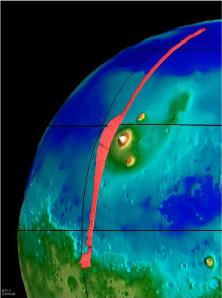
A representation of the Tharsis Ridge, showing the altitude of the volcanoes compared to the surrounding areas. The elevated southern hemisphere is also shown. From Mars Global Surveyor.
Click on image for full size
NASA/JPL
The Tharsis Ridge
This image, taken from the Mars Global Surveyor mission (MGS), shows the Tharsis Ridge, the green/blue area in the middle of the picture, as well as a portion of the southern hemisphere of Mars. The green areas are more elevated than the surroundings, and the yellow/white regions, which are actually Martian volcanoes, are the most elevated of all. The red line in the picture is the spacecraft measurement which indicates just how large the regions are compared to one another.
The Tharsis Ridge is a region about twice the size of the United States (8000 km), and is where many of the volcanoes of Mars are found. Measurements by all spacecraft visiting Mars, including recent ones by Mars Pathfinder and Mars Global Surveyor have indicated that this region of Mars is actually a giant bulge, as shown in the picture. The picture also shows how much more elevated the southern hemisphere of Mars is from the rest of the planet.
The Ridge probably formed about 3.8 Billion years ago, about 250 million years after Mars finished forming out of the solar nebula. Even though that is a very long time ago, planetologists regard this period as somewhat late in Mars' history. This means that Mars probably had a late warming episode, which created the Ridge, with it's associated volcanoes. The Ridge may have been built in a manner similar to the volcanic rises of Venus, namely by a rising hot plume from the deep interior, which formed land on the surface. The cratering record suggests that after this period of activity, all volcanic activity on Mars ceased. There seem to be no features younger than 3.5 Billion Years.
You might also be interested in:

The largest volcano in the solar system is Olympus Mons, shown in the image to the left. Olympus Mons is a Martian shield volcano. The altitude of Olympus Mons is three times the altitude of the largest
...more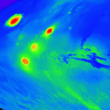
On this map of Mars, the lightly cratered Tharsis Ridge is shown, as well as the heavily cratered Martian highlands (near the bottom of the picture), and Valles Marineris to the right. The volcanoes are
...more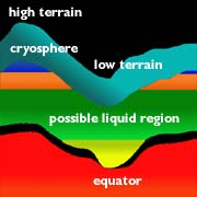
The unusual global geography of Mars helps to explain the fact that water has been drawn from the southern hemisphere to the northern hemisphere of the planet through all of Martian history (that is, from
...moreThe Martian geography is one of high altitudes at high southern latitudes and low altitudes at low latitudes. The ground is less frozen at low latitudes because it is warmer and water can evaporate. Thus,
...more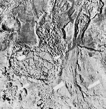
Separate from the Martian outflow channels, or the river valley networks, are large Martian lakes (600 km, or ~1000 miles across) which exhibit evidence of a periodic and catastrophic release of water
...more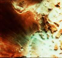
This is an image of fog in a Martian canyon. The presence of fog provides evidence of water, and a water cycle on Mars. More fog has been seen in images returned by Mars Global Surveyor of the south polar
...more
The Martian climate is more influenced by the shape of the Martian orbit than the climate of the Earth is influenced by the shape of the Earth's orbit. The orbit of Mars is more elliptical than that of
...more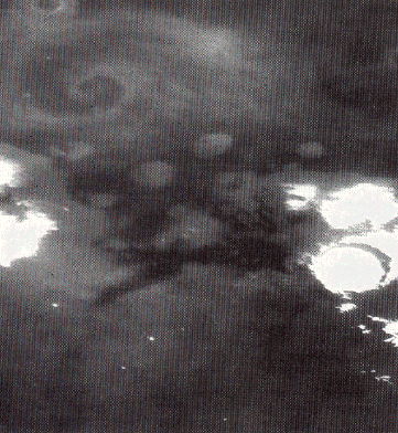
This is an image of a storm moving across the Martian terrain. The camera is looking down upon the storm and the storm front forms a spiral pattern, the same way terrestrial storms are presented on the
...more